Arid Land Geography ›› 2026, Vol. 49 ›› Issue (8): 1700-1710.doi: 10.12118/j.issn.1000-6060.2025.502
• Earth Surface Process • Previous Articles Next Articles
ZHAO Jianrong1,2( ), SHI Hongyan1, NI Honghe1, YANG Wenhua1, LIU Dongwei1,2()
Received:2025-08-22
Revised:2025-09-04
Online:2026-08-25
Published:2026-08-21
Contact:
LIU Dongwei
E-mail:32315087@mail.imu.edu.cn;liudw@imu.edu.cn
ZHAO Jianrong, SHI Hongyan, NI Honghe, YANG Wenhua, LIU Dongwei. Comprehensive evaluation of desertification in the Mongolian Plateau based on a multi-factor linear model[J].Arid Land Geography, 2026, 49(8): 1700-1710.
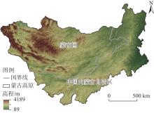
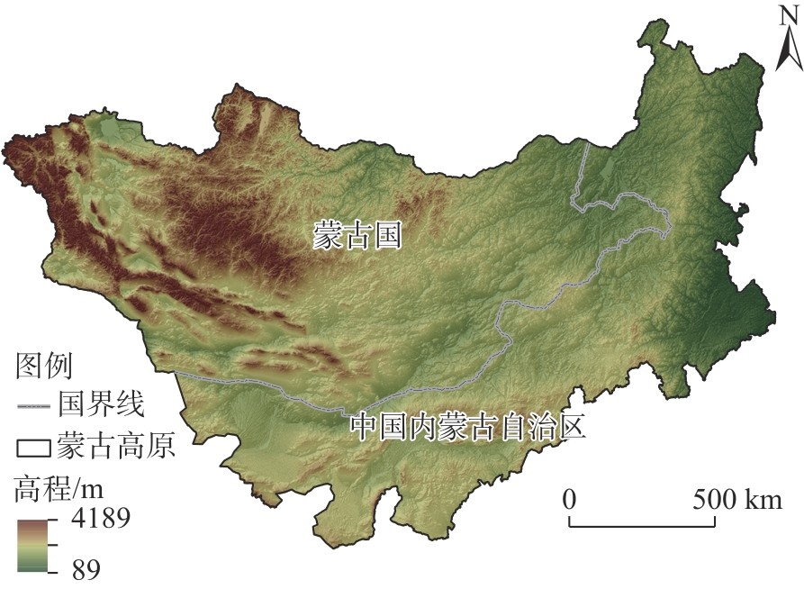
Fig. 1
Schematic diagram of the study area"

Tab. 1
Evaluation indicators and data sources"
| 指标 | 来源 | 空间分辨率 | 时间分辨率 | 来源 |
|---|---|---|---|---|
| 气温/℃ | CRUTS数据集 | 0.5°×0.5° | 年均值 | |
| 降水量/mm | TerraClimate数据集 | 1/24° | 年总量 | |
| NDVI | Modis数据集 | 0.05°×0.05° | 年均值 | |
| NPP/g C∙m-2 | Modis数据集 | 500 m | 年均值 | |
| 土壤水分/mm | TerraClimate数据集 | 1/24° | 年均值 | |
| 土壤有机质/% | HWSD数据集 | 30″ | 固定值 | |
| 人口总数/人 | LandScan数据集 | 30″ | 年度值 | |
Tab. 2
Indicator judgment matrix"
| 指标 | NDVI | NPP | 降水量 | 气温 | 土壤水分 | 土壤有机质 | 人口强度 |
|---|---|---|---|---|---|---|---|
| NDVI | 1 | 1 | 2 | 3 | 2 | 4 | 5 |
| NPP | 1 | 1 | 2 | 3 | 2 | 4 | 5 |
| 降水量 | 1/2 | 1/2 | 1 | 2 | 1 | 3 | 4 |
| 气温 | 1/3 | 1/3 | 1/2 | 1 | 1/2 | 3 | 4 |
| 土壤水分 | 1/2 | 1/2 | 1 | 2 | 1 | 3 | 4 |
| 土壤有机质 | 1/4 | 1/4 | 1/3 | 1/3 | 1/3 | 1 | 2 |
| 人口强度 | 1/5 | 1/5 | 1/4 | 1/4 | 1/4 | 1/2 | 1 |
Tab. 3
Nine-point ratio scale"
| A指标/B指标 | 极次要 | 很次要 | 次要 | 略次要 | 同等 | 略重要 | 重要 | 很重要 | 极重要 |
|---|---|---|---|---|---|---|---|---|---|
| 评价值 | 1/9 | 1/7 | 1/5 | 1/3 | 1 | 3 | 5 | 7 | 9 |
Tab. 4
Expert scoring and weighting results"
| 指标 | 权重 | 分级范围 | 评分 | 指标 | 权重 | 分级范围 | 评分 |
|---|---|---|---|---|---|---|---|
| NDVI | 0.2537 | <0.13 | 1 | 土壤水分 | 0.1494 | <3.26 | 1 |
| 0.13~0.21 | 3 | 3.26~11.95 | 3 | ||||
| 0.21~0.29 | 5 | 11.95~25.70 | 5 | ||||
| 0.29~0.40 | 7 | 25.70~42.36 | 7 | ||||
| >0.40 | 9 | >42.36 | 9 | ||||
| NPP | 0.2537 | <53.39 | 1 | 土壤有机质 | 0.0544 | <0.92 | 1 |
| 53.39~175.00 | 3 | 0.92~1.89 | 3 | ||||
| 175.00~302.55 | 5 | 1.89~2.90 | 5 | ||||
| 302.55~438.99 | 7 | 2.90~4.68 | 7 | ||||
| >438.99 | 9 | >4.68 | 9 | ||||
| 降水量 | 0.1494 | <131.97 | 1 | 人口强度 | 0.0372 | <170 | 9 |
| 131.97~238.75 | 3 | 170~969 | 7 | ||||
| 238.75~345.52 | 5 | 969~3444 | 5 | ||||
| 345.52~465.32 | 7 | 3444~9393 | 3 | ||||
| >465.32 | 9 | >9393 | 1 | ||||
| 气温 | 0.1024 | <-2.63 | 1 | ||||
| -2.63~0.52 | 2 | ||||||
| 0.52~3.75 | 6 | ||||||
| 3.75~7.29 | 5 | ||||||
| >7.29 | 4 |
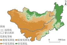
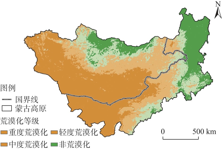
Fig. 2
Spatial distribution of desertification grades in the Mongolian Plateau in 2023"
Tab. 5
Statistics of the mean values of each indicator across different desertification grades in the Mongolian Plateau"
| 荒漠化等级 | NDVI | NPP/g C∙m-2 | 降水量/mm | 气温/℃ | 土壤水分/mm | 土壤有机质/% | 人口强度 |
|---|---|---|---|---|---|---|---|
| 重度荒漠化 | 0.09 | 31.55 | 90.97 | 5.41 | 0.23 | 0.73 | 1.92 |
| 中度荒漠化 | 0.17 | 192.76 | 212.12 | 2.11 | 1.24 | 1.24 | 8.96 |
| 轻度荒漠化 | 0.25 | 293.73 | 309.97 | 2.01 | 5.13 | 1.89 | 14.58 |
| 非荒漠化 | 0.38 | 439.83 | 425.95 | 0.78 | 19.90 | 2.34 | 7.93 |
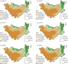
Fig. 3
Distributions of different desertification grades in the Mongolian Plateau from 2001 to 2023"
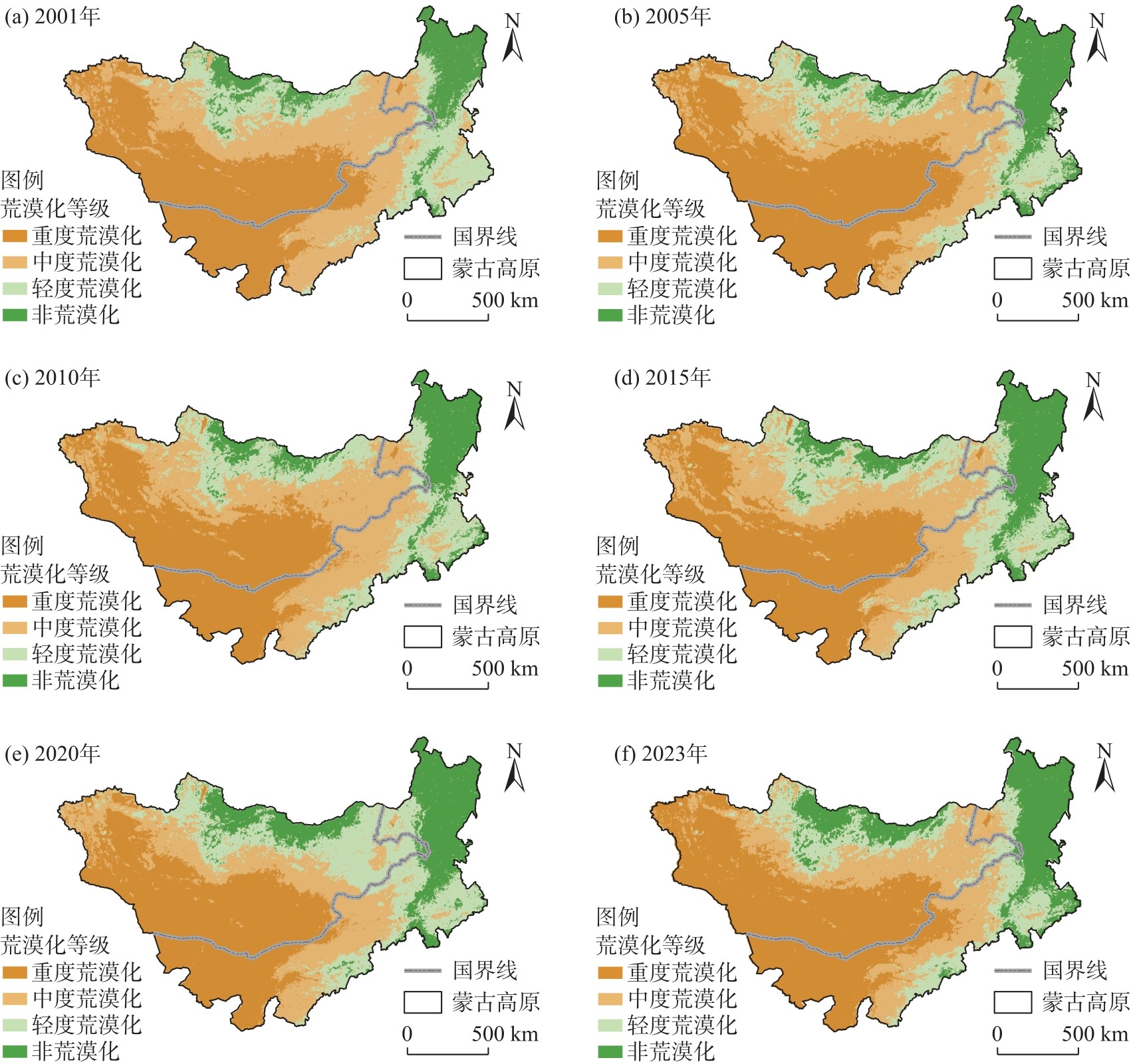
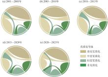
Fig. 4
Trends in area changes across different desertification grades in the Mongolian Plateau from 2001 to 2023"
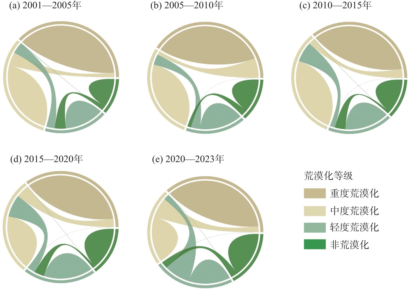
Fig. 5
Migration trajectories of the centers of gravity of areas with different desertification grades in the Mongolian Plateau from 2001 to 2023"
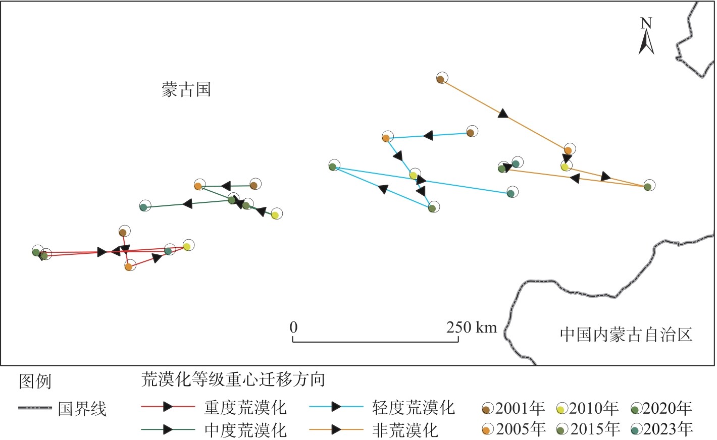
Fig. 6
Desertification change trends in the Mongolian Plateau from 2001 to 2023"
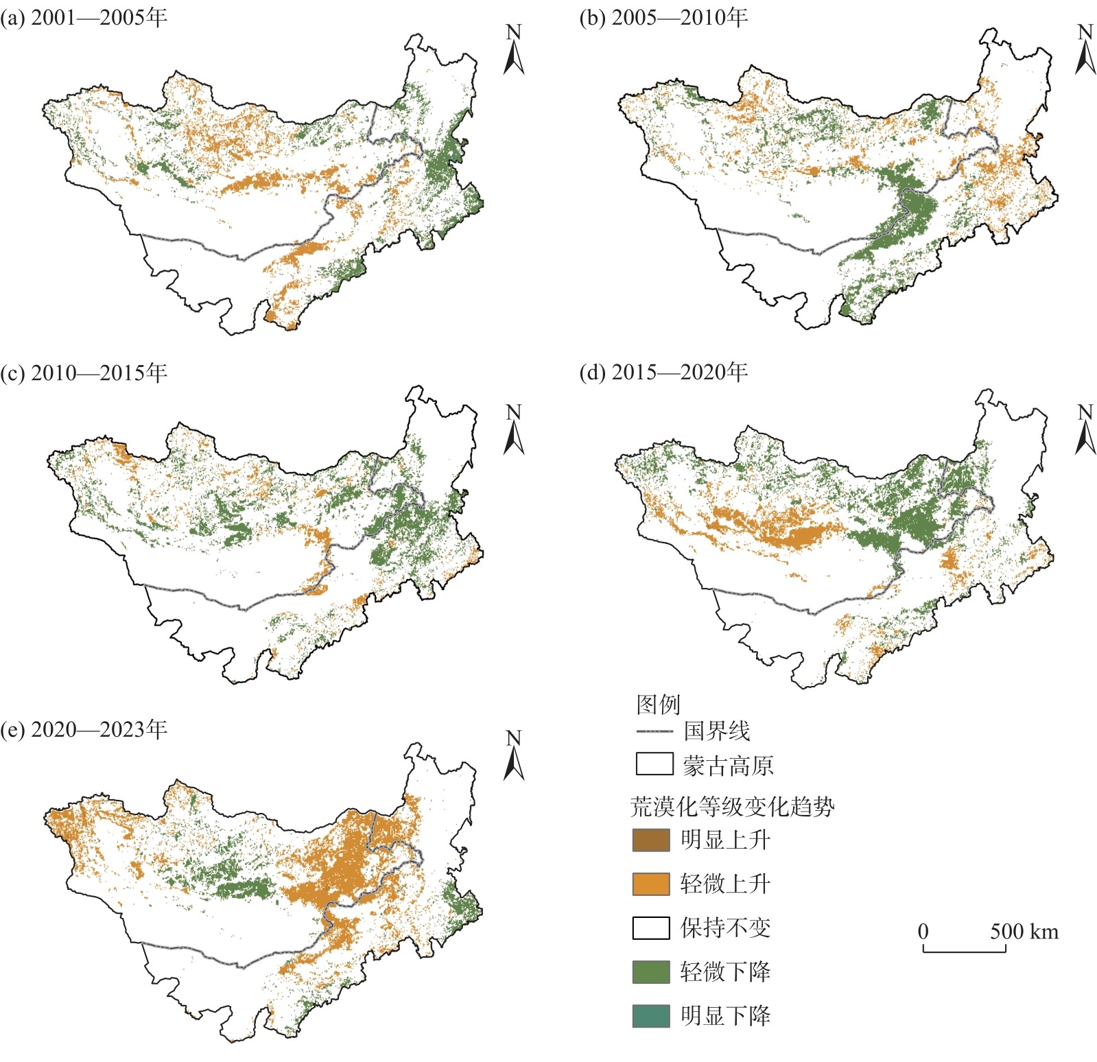
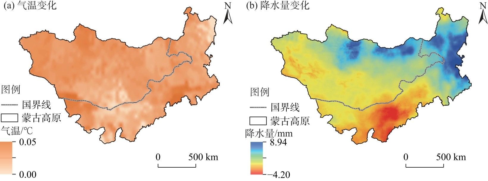
Fig. 7
Trends in air temperature and precipitation amount in the Mongolian Plateau from 2001 to 2023"
| [1] |
张巧凤, 于红博, 黄方. 蒙古高原干旱时空特征及对植被物候的累积影响[J]. 干旱区研究, 2024, 41(9): 1548-1559.
doi: 10.13866/j.azr.2024.09.11 |
|
[Zhang Qiaofeng, Yu Hongbo, Huang Fang. The spatiotemporal dynamics of drought and the cumulative impact on vegetation phenology in the Mongolian Plateau[J]. Arid Zone Research, 2024, 41(9): 1548-1559.]
doi: 10.13866/j.azr.2024.09.11 |
|
| [2] | 周颖, 杨秀春, 徐斌, 等. 我国防沙治沙政策的演进历程与特征研究[J]. 干旱区资源与环境, 2020, 34(1): 123-131. |
| [Zhou Ying, Yang Xiuchun, Xu Bin, et al. Evolution and characteristics of China’s national defense policies for sand control[J]. Journal of Arid Land Resources and Environment, 2020, 34(1): 123-131.] | |
| [3] | 朱震达, 刘恕. 关于沙漠化的概念及其发展程度的判断[J]. 中国沙漠, 1984, 4(3): 2-8. |
| [Zhu Zhenda, Liu Shu. The concept of desertification and the differentiation of its development[J]. Journal of Desert Research, 1984, 4(3): 2-8.] | |
| [4] | Berry L, Ford R B. Recommendations for a system to monitor critical indicators in areas prone to desertification: A report[R]. Worcester, MA: Clark University, 1977. |
| [5] | Reining P. Handbook on desertification indicators[M]. Washington, D.C.: American Association for the Advancement of Science, 1978: 1-141. |
| [6] | 闫峰, 吴波. 近40 a毛乌素沙地荒漠化过程研究[J]. 干旱区地理, 2013, 36(6): 987-996. |
| [Yan Feng, Wu Bo. Desertification progress in Mu Us Sandy Land over the past 40 years[J]. Arid Land Geography, 2013, 36(6): 987-996.] | |
| [7] | 王锋, 褚建民, 王学全, 等. 库姆塔格沙漠研究: 进展与成果[J]. 资源与生态学报, 2011, 2(3): 193-201. |
|
[Wang Feng, Chu Jianmin, Wang Xuequan, et al. A study of Kumtag Desert: Progresses and achievements[J]. Journal of Resources and Ecology, 2011, 2(3): 193-201.]
doi: 10.3969/j.issn.1674-764x.2011.03.001 |
|
| [8] | 席磊, 冯益明, 戚曌, 等. 基于综合评价指数的塔里木盆地荒漠化风险评估[J]. 生态学报, 2025, 45(3): 1126-1136. |
| [Xi Lei, Feng Yiming, Qi Zhao, et al. Risk assessment of desertification in Tarim Basin based on comprehensive evaluation index[J]. Acta Ecologica Sinica, 2025, 45(3): 1126-1136.] | |
| [9] |
Ren Q D E J, Li N, Zhang W M. Research on sand-dust storm forecasting based on deep neural network with stacking ensemble learning[J]. IEEE Access, 2022, 10: 111855-111863.
doi: 10.1109/ACCESS.2022.3216309 |
| [10] | Xu S X, Wang J L, Altansukh O, et al. Spatiotemporal evolution and driving mechanisms of desertification on the Mongolian Plateau[J]. Science of the Total Environment, 2024, 941: 173566, doi: 10.1016/j.scitotenv.2024.173566. |
| [11] |
高彦哲, 阿拉腾图娅, 昙娜, 等. 2000—2020年蒙古高原湖泊变化及其影响因素分析[J]. 干旱区地理, 2023, 46(2): 191-200.
doi: 10.12118/j.issn.1000-6060.2022.424 |
|
[Gao Yanzhe, Alatengtuya, Tan Na, et al. Lake changes and their influence factors in the Mongolian Plateau from 2000 to 2020[J]. Arid Land Geography, 2023, 46(2): 191-200.]
doi: 10.12118/j.issn.1000-6060.2022.424 |
|
| [12] | 赵玉灵. 基于层次分析法的矿山环境评价方法研究——以海南岛为例[J]. 国土资源遥感, 2020, 32(1): 148-153. |
| [Zhao Yuling. Study and application of analytic hierarchy process of mine geological environment: A case study in Hainan Island[J]. Remote Sensing for Land and Resources, 2020, 32(1): 148-153.] | |
| [13] | Na R S, Du H B, Li N, et al. Spatiotemporal changes in the aeolian desertification of Hulunbuir Grassland and its driving factors in China during 1980—2015[J]. Catena, 2019, 182: 104123, doi: 10.1016/j.catena.2019.104123. |
| [14] | Guo B, Wei C X, Yu Y, et al. The dominant influencing factors of desertification changes in the source region of Yellow River: Climate change or human activity?[J]. Science of the Total Environment, 2022, 813: 152512, doi: 10.1016/j.scitotenv.2021.152512. |
| [15] |
Herrmann S M, Anyamba A, Tucker C J. Recent trends in vegetation dynamics in the African Sahel and their relationship to climate[J]. Global Environmental Change, 2005, 15(4): 394-404.
doi: 10.1016/j.gloenvcha.2005.08.004 |
| [16] |
Pueyo Y, Moret-Fernández D, Saiz H, et al. Relationships between plant spatial patterns, water infiltration capacity, and plant community composition in semi-arid Mediterranean ecosystems along stress gradients[J]. Ecosystems, 2013, 16(3): 452-466.
doi: 10.1007/s10021-012-9620-5 |
| [17] |
Zhu Y K, Zhang J T, Zhang Y Q, et al. Responses of vegetation to climatic variations in the desert region of northern China[J]. Catena, 2019, 175: 27-36.
doi: 10.1016/j.catena.2018.12.007 |
| [18] |
Hirschi M, Seneviratne S I, Alexandrov V, et al. Observational evidence for soil-moisture impact on hot extremes in southeastern Europe[J]. Nature Geoscience, 2011, 4(1): 17-21.
doi: 10.1038/ngeo1032 |
| [19] | 董金义, 罗敏, 孟凡浩, 等. 蒙古高原土壤水分时空格局演变特征分析[J]. 水土保持研究, 2024, 31(2): 110-121. |
| [Dong Jinyi, Luo Min, Meng Fanhao, et al. Spatiotemporal evolution of soil moisture and its driving forces in the Mongolian Plateau[J]. Research of Soil and Water Conservation, 2024, 31(2): 110-121.] | |
| [20] | 王志国. 乌拉特荒漠区域土壤特征及其与植被类型的关系[D]. 呼和浩特: 内蒙古农业大学, 2021. |
| [Wang Zhiguo. Soil characteristics and their relationship with vegetation types in the Urat Desert[D]. Hohhot: Inner Mongolia Agricultural University, 2021.] | |
| [21] | 李中恺, 李小雁, 周沙, 等. 土壤-植被-水文耦合过程与机制研究进展[J]. 中国科学: 地球科学, 2022, 52(11): 2105-2138. |
| [Li Zhongkai, Li Xiaoyan, Zhou Sha, et al. A comprehensive review on coupled processes and mechanisms of soil-vegetation-hydrology, and recent research advances[J]. Science China: Earth Sciences, 2022, 52(11): 2105-2138.] | |
| [22] | 王琪, 王建梅, 张继平, 等. 荒漠化监测样地不同立地类型土壤有机质测定分析[J]. 防护林科技, 2023(5): 10-11, 32. |
| [Wang Qi, Wang Jianmei, Zhang Jiping, et al. Determination and analysis of soil organic matter in different site types of desertification monitoring plots[J]. Protection Forest Science and Technology, 2023(5): 10-11, 32.] | |
| [23] |
杜佳梦, 包刚, 佟斯琴, 等. 1982—2015年蒙古国植被覆盖变化及其与气候变化和人类活动的关系[J]. 草业学报, 2021, 30(2): 1-13.
doi: 10.11686/cyxb2020311 |
| [Du Jiameng, Bao Gang, Tong Siqin, et al. Variations in vegetation cover and its relationship with climate change and human activities in Mongolia during the period 1982—2015[J]. Acta Prataculturae Sinica, 2021, 30(2): 1-13.] | |
| [24] | Liu Q F, Zhang Q, Yan Y Z, et al. Ecological restoration is the dominant driver of the recent reversal of desertification in the Mu Us Desert (China)[J]. Journal of Cleaner Production, 2020, 268: 122241, doi: 10.1016/j.jclepro.2020.122241. |
| [25] | Meng X Y, Gao X, Li S, et al. Monitoring desertification in Mongolia based on Landsat images and Google Earth Engine from 1990 to 2020[J]. Ecological Indicators, 2021, 129: 107908, doi: 10.1016/j.ecolind.2021.107908. |
| [26] | 超宝, 赵媛媛, 武海岩, 等. 2000—2020年蒙古高原生态系统服务及其对气候因子的响应[J]. 干旱区地理, 2024, 47(9): 1577-1586. |
|
[Chao Bao, Zhao Yuanyuan, Wu Haiyan, et al. Ecosystem services and its response to climate factors in the Mongolian Plateau from 2000 to 2020[J]. Arid Land Geography, 2024, 47(9): 1577-1586.]
doi: 10.12118/j.issn.1000-6060.2023.602 |
|
| [27] |
黄治鹏, 黄毅, 杨全俊, 等. 蒙古国草地农业及对我国的启示[J]. 草业学报, 2023, 32(6): 1-15.
doi: 10.11686/cyxb2022265 |
| [Huang Zhipeng, Huang Yi, Yang Quanjun, et al. The grassland agriculture of Mongolia and its capacity to inform development in China[J]. Acta Prataculturae Sinica, 2023, 32(6): 1-15.] | |
| [28] |
Qi Y B, Chang Q R, Jia K L, et al. Temporal-spatial variability of desertification in an agro-pastoral transitional zone of northern Shaanxi Province, China[J]. Catena, 2012, 88(1): 37-45.
doi: 10.1016/j.catena.2011.08.003 |
| [29] |
Bryan B A, Gao L, Ye Y, et al. China’s response to a national land-system sustainability emergency[J]. Nature, 2018, 559(7713): 193-204.
doi: 10.1038/s41586-018-0280-2 |
| [30] |
Jia X Q, Fu B J, Feng X M, et al. The tradeoff and synergy between ecosystem services in the grain-for-green areas in northern Shaanxi, China[J]. Ecological Indicators, 2014, 43: 103-113.
doi: 10.1016/j.ecolind.2014.02.028 |
| [31] |
Wu Z T, Wu J J, Liu J H, et al. Increasing terrestrial vegetation activity of ecological restoration program in the Beijing-Tianjin sand source region of China[J]. Ecological Engineering, 2013, 52: 37-50.
doi: 10.1016/j.ecoleng.2012.12.040 |
| [32] | Liang X Y, Li P F, Wang J L, et al. Research progress of desertification and its prevention in Mongolia[J]. Sustainability, 2021, 13(12): 6861, doi: 10.3390/su13126861. |
| [1] | ZHANG Qifei, YUAN Zebin, CHEN Yaning, XIANG Yanyun, JIA Rong, LIU Yuting. Spatiotemporal dynamic changes of typical lakes on the northern slope of Kunlun Mountains from 1990 to 2024 [J]. Arid Land Geography, 2026, 49(8): 1531-1544. |
| [2] | ZHAI Yongjian, YAO Junqiang, QIN Yan. Progress on climate change and its impacts in the arid Central Asia: A bibliometric analysis [J]. Arid Land Geography, 2026, 49(8): 1545-1559. |
| [3] | LI Sen, YU Tengfei, ZHAO Hongyan, ZHANG Zhishan, YAN Changzhen. Spatiotemporal changes of aeolian desertification over the past 50 years and driving force analysis during the reversal period in the central Ningxia arid zone, China [J]. Arid Land Geography, 2026, 49(8): 1663-1674. |
| [4] | WEN Mingjun, WU Zhitao, DU Ziqiang, LIANG Hanxue, CHEN Xin, LEI Tianjie. Ecological drought monitoring and spatiotemporal changes in the Mongolian Plateau [J]. Arid Land Geography, 2026, 49(7): 1311-1322. |
| [5] | GUAN Jingyun, SUN Zhiyang, XU Xiaoliang, CHENG Yifeng, SONG Beibei, FANG Ruiying. Spatiotemporal evolution of tourism climate comfort in Xinjiang, China and five Central Asian countries under climate change [J]. Arid Land Geography, 2026, 49(4): 697-712. |
| [6] | LIU Yaqi, LI Jianyong, WANG Ninglian, RAN Yi. Quantitative reconstructions of paleofire and their driving mechanisms in Wenquan County, western Tianshan Mountains over the past 5000 years [J]. Arid Land Geography, 2026, 49(4): 804-815. |
| [7] | ZHANG Bo, XU Honggang. A review of the impacts and risks of climate change on mountain glacier tourism [J]. Arid Land Geography, 2026, 49(3): 474-483. |
| [8] | CHEN Bing, WANG Futao, WANG Shixin, GU Xingguang, ZHU Jinfeng. Characteristics and driving factors of glacial lake changes in transboundary basins between China and Bhutan [J]. Arid Land Geography, 2026, 49(3): 496-507. |
| [9] | CAO Xiaoyun, ZHOU Bingrong, LEI Chunmiao, LIU Zhiyuan, SHI Feifei, YAN Yuqian. Spatiotemporal changes of snow depth and climate attribution in the Three River Source Region from 1980 to 2020 based on remote sensing monitoring [J]. Arid Land Geography, 2026, 49(2): 356-368. |
| [10] | ZHANG Fei, LI Jian, LI Huirong, XIE Tao, ZHANG Xuehong, WANG Chao, BAI Shuying, SONG Zhengshan. Spatiotemporal characteristics of net primary productivity and its response to influencing factors in Xilin Gol League grassland from 2001 to 2024 [J]. Arid Land Geography, 2025, 48(9): 1555-1566. |
| [11] | LI Wenhua, LI Shengyu, XU Xinwen, MIAO Jiamin, LYU Zhentao. Predicting the potential distribution of Artemisia songarica in Xinjiang under climate change based on the MaxEnt model [J]. Arid Land Geography, 2025, 48(9): 1578-1588. |
| [12] | ZHANG Kexin, ZHAO Yujuan, LI Meiyu. Hail climate characteristics and influencing factors in eastern Gansu Province from 1978 to 2023 [J]. Arid Land Geography, 2025, 48(8): 1374-1384. |
| [13] | Wujisiguleng , Narisu , LI Na, YIN Shan, Wuyundalai , LI Mingxing, LAI Shaojie. Spatiotemporal pattern evolution of land desertification sensitivity in Hulun Buir grassland from 2001 to 2020 [J]. Arid Land Geography, 2025, 48(5): 825-837. |
| [14] | CHEN Shilong, MENG Qingkai, DAI Yong, YANG Liqiang, WU Han. Geological disaster hazard assessment and prediction in the Ili River Basin based on CMIP6 future scenarios [J]. Arid Land Geography, 2025, 48(4): 599-611. |
| [15] | FEI Bingqiang, WU Bo, YIN Jie, DONG Chunyuan, MA Huirong, XIU Xiaomin, JIA Xiaohong, PANG Yingjun, ZHANG Ping. Changes in the spatial pattern of newly cultivated and abandoned farmland in the Mu Us Sandy Land from 1964 to 2020 and their impact on desertification [J]. Arid Land Geography, 2025, 48(4): 661-672. |
|
||

