- 2025年4月26日 星期六
干旱区地理 ›› 2021, Vol. 44 ›› Issue (4): 1175-1185.doi: 10.12118/j.issn.1000–6060.2021.04.29
黄越1( ),程静2(),王鹏2
收稿日期:2020-06-12
修回日期:2020-12-31
出版日期:2021-07-25
发布日期:2021-08-02
通讯作者:
程静
作者简介:黄越(1988-),男,助教,主要从事人文地理与生态经济研究. E-mail: 基金资助:
HUANG Yue1(),CHENG Jing2(),WANG Peng2
Received:2020-06-12
Revised:2020-12-31
Online:2021-07-25
Published:2021-08-02
Contact:
Jing CHENG
摘要:
生态脆弱性是当前全球环境变化与区域可持续发展研究的重点,也是生态文明建设和绿色发展研究的热点。以中国北方农牧交错区盐池县为例,基于2000—2017年3期遥感数据,运用景观格局指数法、空间自相关以及地理探测器等模型对研究区生态脆弱性时空演变格局及其驱动因素进行综合评价。结果显示:(1) 研究区草地分布广泛,且面积逐年增加,耕地和未利用地面积分别减少44673.7 hm2和73033.1 hm2,林地、水域和建设用地面积增加迅速,年均变化率分别为2.86%、2.15%和4.80%;(2) 景观斑块数量减少,破碎度趋于缓和,不同类型景观彼此之间具有良好的连接性,景观格局趋向规则、连续的整体演变;研究区景观生态脆弱性逐年下降,高脆弱分布区主要分布在北部的高沙窝镇、花马池镇以及西部的惠安堡镇,低脆弱区主要分布在东南部的麻黄山镇、大水坑镇以及青山乡等地区,且低脆弱区范围由东南向西北延伸;空间自相关Moran’s I大于0.52,表明存在正相关,空间具有显著的集聚性和异质性,且呈现出“东南低,西北高”的分布格局;地理探测器结果显示景观斑块数、破碎度、优势度以及香浓多样性指数是影响研究区生态脆弱性空间异质性的主要因素。
黄越,程静,王鹏. 中国北方农牧交错区生态脆弱性时空演变格局与驱动因素——以盐池县为例[J]. 干旱区地理, 2021, 44(4): 1175-1185.
HUANG Yue,CHENG Jing,WANG Peng. Spatiotemporal evolution pattern and driving factors of ecological vulnerability in agro-pastoral region in northern China: A case of Yanchi County in Ningxia[J]. Arid Land Geography, 2021, 44(4): 1175-1185.

图1
研究区地理位置"

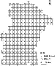
图2
评价单元划分"

表1
2000—2017年盐池县景观面积变化"
| 年份 | 项目 | 耕地 | 林地 | 草地 | 水域 | 建设用地 | 未利用地 |
|---|---|---|---|---|---|---|---|
| 2000 | 面积/hm2 | 214131.27 | 83211.15 | 377689.95 | 9220.58 | 25777.45 | 127698.94 |
| 比例/% | 25.56 | 9.93 | 45.08 | 1.10 | 3.08 | 15.24 | |
| 2008 | 面积/hm2 | 189927.18 | 105415.27 | 412605.18 | 11267.99 | 32484.44 | 86029.31 |
| 比例/% | 22.67 | 12.58 | 49.25 | 1.35 | 3.88 | 10.27 | |
| 2017 | 面积/hm2 | 169457.57 | 123698.84 | 430485.28 | 12595.88 | 46825.93 | 54665.84 |
| 比例/% | 20.23 | 14.77 | 51.39 | 1.50 | 5.59 | 6.53 | |
| 2000—2008 | 变化率/% | -0.66 | 1.57 | 0.54 | 1.31 | 1.53 | -1.92 |
| 2008—2017 | 变化率/% | -0.63 | 1.02 | 0.25 | 0.69 | 2.60 | -2.14 |
| 2000—2017 | 变化率/% | -1.23 | 2.86 | 0.82 | 2.15 | 4.80 | -3.36 |
表2
2000—2017年盐池县景观类型格局指数"
| 景观类型 | 年份 | 斑块密度/块·hm-2 | 边缘密度/m·hm-2 | 最大斑块指数/% | 平均斑块面积/hm2 |
|---|---|---|---|---|---|
| 耕地 | 2000 | 1.426 | 14.253 | 13.157 | 237.542 |
| 2008 | 1.539 | 16.557 | 11.036 | 212.375 | |
| 2017 | 1.692 | 17.952 | 10.268 | 199.483 | |
| 林地 | 2000 | 0.563 | 7.442 | 0.619 | 56.593 |
| 2008 | 0.497 | 6.129 | 0.843 | 62.469 | |
| 2017 | 0.423 | 5.622 | 1.236 | 69.342 | |
| 草地 | 2000 | 2.463 | 22.649 | 23.548 | 204.861 |
| 2008 | 2.169 | 19.429 | 25.529 | 396.483 | |
| 2017 | 1.837 | 17.449 | 27.334 | 475.252 | |
| 水域 | 2000 | 0.359 | 6.253 | 0.816 | 29.354 |
| 2008 | 0.372 | 5.972 | 0.849 | 35.559 | |
| 2017 | 0.409 | 6.128 | 0.926 | 39.608 | |
| 建设用地 | 2000 | 0.842 | 0.573 | 0.428 | 47.529 |
| 2008 | 0.719 | 0.591 | 0.627 | 52.267 | |
| 2017 | 0.568 | 0.463 | 0.934 | 59.346 | |
| 未利用地 | 2000 | 0.423 | 0.396 | 0.716 | 27.689 |
| 2008 | 0.476 | 0.463 | 0.529 | 25.466 | |
| 2017 | 0.545 | 0.579 | 0.337 | 22.537 |
表3
2000—2017年盐池县景观格局指数变化"
| 年份 | 斑块数/个 | 面积加权平均形状指数 | 蔓延度指数 | 香浓多样性指数 | 香浓均匀度指数 |
|---|---|---|---|---|---|
| 2000 | 7647 | 24.68 | 59.15 | 0.91 | 0.64 |
| 2008 | 7269 | 21.19 | 58.49 | 0.89 | 0.62 |
| 2017 | 6873 | 19.43 | 58.05 | 0.88 | 0.61 |
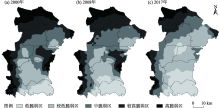
图3
2000—2017年盐池县生态脆弱性空间分布"
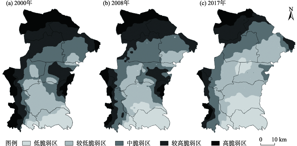
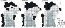
图4
2000—2017年盐池县生态脆弱性LISA空间分布"

表4
盐池县生态脆弱性影响因素探测q值"
| 影响因素 | 2000年 | 2008年 | 2017年 |
|---|---|---|---|
| 景观斑块数 | 0.568 | 0.554 | 0.561 |
| 景观破碎度 | 0.627 | 0.593 | 0.546 |
| 景观分离度 | 0.455 | 0.376 | 0.439 |
| 景观优势度 | 0.469 | 0.522 | 0.573 |
| 景观易损度 | 0.433 | 0.416 | 0.429 |
| 香浓多样性指数 | 0.463 | 0.522 | 0.569 |
| 香浓均匀度指数 | 0.326 | 0.297 | 0.318 |
| 斑块密度指数 | 0.343 | 0.357 | 0.352 |
| [1] | 王贝贝, 丁明军, 管琪卉, 等. 基于格网的南昌市生态环境脆弱性评价[J]. 生态学报, 2019, 39(15):5460-5472. |
| [ Wang Beibei, Ding Mingjun, Guan Qihui, et al. Gridded assessment of eco-environmental vulnerability in Nanchang City[J]. Acta Ecologica Sinica, 2019, 39(15):5460-5472. ] | |
| [2] | 靳毅, 蒙吉军. 生态脆弱性评价与预测研究进展[J]. 生态学杂志, 2011, 30(11):2646-2652. |
| [ Jin Yi, Meng Jijun. Assessment and forecast of ecological vulnerability: A review[J]. Chinese Journal of Ecology, 2011, 30(11):2646-2652. ] | |
| [3] | 张学玲, 余文波, 蔡海生, 等. 区域生态环境脆弱性评价方法研究综述[J]. 生态学报, 2018, 38(16):5970-5981. |
| [ Zhang Xueling, Yu Wenbo, Cai Haisheng, et al. Review of the evaluation methods of regional eco-environmental vulnerability[J]. Acta Ecologica Sinica, 2018, 38(16):5970-5981. ] | |
| [4] | 田亚平, 常昊. 中国生态脆弱性研究进展的文献计量分析[J]. 地理学报, 2012, 67(11):1515-1525. |
| [ Tian Yaping, Chang Hao. Bibliometric analysis of research progress on ecological vulnerability in China[J]. Journal of Geographical Sciences, 2012, 67(11):1515-1525. ] | |
| [5] |
陈萍, 陈晓玲. 全球环境变化下人-环境耦合系统的脆弱性研究综述[J]. 地理科学进展, 2010, 29(4):454-462.
doi: 10.11820/dlkxjz.2010.04.010 |
|
[ Chen Ping, Chen Xiaoling. Summary on research of coupled human-environment system vulnerability under global environmental change[J]. Progress in Geography, 2010, 29(4):454-462. ]
doi: 10.11820/dlkxjz.2010.04.010 |
|
| [6] | 刘晶, 刘学录, 侯莉敏. 祁连山东段山地景观格局变化及其生态脆弱性分析[J]. 干旱区地理, 2012, 35(5):795-805. |
| [ Liu Jing, Liu Xuelu, Hou Limin. Mountain landscape pattern changes and ecological vulnerability analysis in the eastern part of Qilian Mountains[J]. Arid Land Geography, 2012, 35(5):795-805. ] | |
| [7] | 贾晶晶, 赵军, 王建邦, 等. 基于SRP模型的石羊河流域生态脆弱性评价[J]. 干旱区资源与环境, 2020, 34(1):34-41. |
| [ Jia Jingjing, Zhao Jun, Wang Jianbang, et al. Ecological vulnerability assessment of Shiyang River Basin based on SRP model[J]. Journal of Arid Land Resources and Environment, 2020, 34(1):34-41. ] | |
| [8] | 田鹏, 李加林, 姜忆湄, 等. 海湾景观生态脆弱性及其对人类活动的响应——以东海区为例[J]. 生态学报, 2019, 39(4):1463-1474. |
| [ Tian Peng, Li Jialin, Jiang Yimei, et al. Ecological vulnerability of the bay landscape and its response to human activities: A case study of the East China Sea[J]. Acta Ecologica Sinica, 2019, 39(4):1463-1474. ] | |
| [9] | 付刚, 白加德, 齐月, 等. 基于GIS的北京市生态脆弱性评价[J]. 生态与农村环境学报, 2018, 34(9):830-839. |
| [ Fu Gang, Bai Jiade, Qi Yue, et al. Ecological vulnerability assessment in Beijing based on GIS spatial analysis[J]. Journal of Ecology and Rural Environment, 2018, 34(9):830-839. ] | |
| [10] | 韩鑫, 刘传胜, 胡江玲, 等. 新疆天山自然遗产地景观格局动态演化及其生态健康评价[J]. 干旱区地理, 2019, 42(1):195-205. |
| [ Han Xin, Liu Chuansheng, Hu Jiangling, et al. Dynamic evolution of landscape pattern and ecological health evaluation of natural heritage sites in Tianshan Mountains, Xinjiang[J]. Arid Land Geography, 2019, 42(1):195-205. ] | |
| [11] | 魏晓旭, 赵军, 魏伟, 等. 中国县域单元生态脆弱性时空变化研究[J]. 环境科学学报, 2016, 36(2):726-739. |
| [ Wei Xiaoxu, Zhao Jun, Wei Wei, et al. Spatial and temporal changes of ecological vulnerability per county unit in China[J]. Acta Scientiae Circumstantiae, 2016, 36(2):726-739. ] | |
| [12] | 林金煌, 胡国建, 祁新华, 等. 闽三角城市群生态环境脆弱性及其驱动力[J]. 生态学报, 2018, 38(12):4155-4166. |
| [ Lin Jinhuang, Hu Guojian, Qi Xinhua, et al. Ecological environmental vulnerability and its driving forces in urban agglomeration in the Fujian Delta Region[J]. Acta Ecologica Sinica, 2018, 38(12):4155-4166. ] | |
| [13] | 田海宁. 汉中市生态脆弱性评价及空间分布规律研究[J]. 中国农业资源与区划, 2017, 38(3):148-152. |
| [ Tian Haining. The ecological vulnerability assessment and spatial distribution of Hanzhong City[J]. Chinese Journal of Agricultural Resources and Regional Planning, 2017, 38(3):148-152. ] | |
| [14] |
王群, 银马华, 杨兴柱, 等. 大别山贫困区旅游地社会-生态系统脆弱性时空演变与影响机理[J]. 地理学报, 2019, 74(8):1663-1679.
doi: 10.11821/dlxb201908013 |
|
[ Wang Qun, Yin Mahua, Yang Xingzhu, et al. Spatio-temporal evolution and impact mechanism of socio-ecological system vulnerability in poor mountainous tourist distinations: Taking Dabie Mountain Area as example[J]. Acta Geographica Sinica, 2019, 74(8):1663-1679. ]
doi: 10.11821/dlxb201908013 |
|
| [15] | 赵越, 罗志军, 李雅婷, 等. 赣江上游流域景观生态风险的时空分异——从生产-生活-生态空间的视角[J]. 生态学报, 2019, 39(13):4676-4686. |
| [ Zhao Yue, Luo Zhijun, Li Yating, et al. Study of the spatial-temporal variation of landscape ecological risk in the upper reaches of the Ganjiang River Basin based on the “production-living-ecological space”[J]. Acta Ecologica Sinica, 2019, 39(13):4676-4686. ] | |
| [16] |
Focks A, Ter H M, Erik V D B, et al. Integrating chemical fate and population-level effect models for pesticides at landscape scale: New options for risk assessment[J]. Ecological Modelling, 2014, 280:102-116.
doi: 10.1016/j.ecolmodel.2013.09.023 |
| [17] |
Zhang W Q, Shan B Q, Li J, et al. Characteristics, distribution and ecological risk assessment of phosphorus in surface sediments from different ecosystems in eastern China: A 31P-nuclear magnetic resonance study[J]. Ecological Engineering, 2015, 75:264-271.
doi: 10.1016/j.ecoleng.2014.11.055 |
| [18] | 王媛, 周长威. 黔中城市群景观生态安全格局构建[J]. 生态与农村环境学报, 2019, 35(9):1111-1117. |
| [ Wang Yuan, Zhou Changwei. Landscape ecological security pattern in central Guizhou urban agglomeration[J]. Journal of Ecology and Rural Environment, 2019, 35(9):1111-1117. ] | |
| [19] | 李冲, 张璇, 吴一帆, 等. 京津冀生态屏障区景观格局变化及其对水源涵养的影响[J]. 中国环境科学, 2019, 39(6):2588-2595. |
| [ Li Chong, Zhang Xuan, Wu Yifan, et al. Landscape pattern change of the ecological barrier zone in Beijing-Tianjin-Hebei region and its impact on water conservation[J]. China Environmental Science, 2019, 39(6):2588-2595. ] | |
| [20] | 董雅雯, 佘济云, 陈冬洋, 等. 基于景观格局及生态敏感性的三亚市景观脆弱度研究[J]. 西南林业大学学报, 2016, 36(4):103-108. |
| [ Dong Yawen, She Jiyun, Chen Dongyang, et al. Landscape vulnerability analysis of Sanya City based on the landscape pattern and ecological sensibility[J]. Journal of Southwest Forestry University, 2016, 36(4):103-108. ] | |
| [21] | 王鹏, 王亚娟, 刘小鹏, 等. 基于景观结构的生态移民安置区生态风险评价——以宁夏红寺堡区为例[J]. 生态学报, 2018, 38(8):2672-2682. |
| [ Wang Peng, Wang Yajuan, Liu Xiaopeng, et al. Ecological risk assessment of an ecological migrant resettlement region based on landscape structure: A case study of Hongsibu in Ningxia[J]. Acta Ecologica Sinica, 2018, 38(8):2672-2682. ] | |
| [22] |
Sati P V. Landscape vulnerability and rehabilitation issues: A study of hydropower projects in Garhwal region, Himalaya[J]. Natural Hazards, 2015, 75(3):2265-2278.
doi: 10.1007/s11069-014-1430-y |
| [23] | Thomas M F. Landscape sensitivity in time and space: An introduction[J]. Catena, 2001, 42(2):2265-2278. |
| [24] | 孙鸿超, 张正祥. 吉林省松花江流域景观格局脆弱性变化及其驱动力[J]. 干旱区研究, 2019, 36(4):1005-1014. |
| [ Sun Hongchao, Zhang Zhengxiang. Change of landscape pattern vulnerability in the Songhua River Basin in Jilin Province and its driving forces[J]. Arid Zone Research, 2019, 36(4):1005-1014. ] | |
| [25] |
邹君, 刘媛, 谭芳慧, 等. 传统村落景观脆弱性及其定量评价——以湖南省新田县为例[J]. 地理科学, 2018, 38(8):1292-1300.
doi: 10.13249/j.cnki.sgs.2018.08.011 |
|
[ Zou Jun, Liu Yuan, Tan Fanghui, et al. Landscape vulnerability and quantitative evaluation of traditional villages: A case study of Xintian County, Hunan Province[J]. Scientia Geographica Sinica, 2018, 38(8):1292-1300. ]
doi: 10.13249/j.cnki.sgs.2018.08.011 |
|
| [26] | 李文龙, 石育中, 鲁大铭, 等. 北方农牧交错带干旱脆弱性时空格局演变[J]. 自然资源学报, 2018, 33(9):1599-1612. |
| [ Li Wenlong, Shi Yuzhong, Lu Daming, et al. The spatio-temporal evolution of drought vulnerability in the ecotone between agriculture and animal husbandry in the north of China[J]. Journal of Natural Resources, 2018, 33(9):1599-1612. ] | |
| [27] | 李旭亮, 杨礼箫, 田伟, 等. 中国北方农牧交错带土地利用/覆盖变化研究综述[J]. 应用生态学报, 2018, 29(10):3487-3495. |
| [ Li Xuliang, Yang Lixiao, Tian Wei, et al. Land use and land cover change in agro-pastoral ecotone in northern China: A review[J]. Chinese Journal of Applied Ecology, 2018, 29(10):3487-3495. ] | |
| [28] |
David M, Yang Z Q, Waeern B C, et al. A forest vulnerability index based on drought and high temperatures[J]. Remote Sensing of Environment, 2016, 173:314-325.
doi: 10.1016/j.rse.2015.11.024 |
| [29] | 张金茜, 李红瑛, 曹二佳, 等. 多尺度流域生态脆弱性评价及其空间关联性——以甘肃白龙江流域为例[J]. 应用生态学报, 2018, 29(9):2897-2906. |
| [ Zhang Jinqian, Li Hongying, Cao Erjia, et al. Assessment of ecological vulnerability in multi-scale and its spatial correlation: A case study of Bailongjiang Watershed in Gansu Province, China[J]. Chinese Journal of Applied Ecology, 2018, 29(9):2897-2906. ] | |
| [30] | 韩振华, 李建东, 殷红, 等. 基于景观格局的辽河三角洲湿地生态安全分析[J]. 生态环境学报, 2010, 19(3):701-705. |
| [ Han Zhenhua, Li Jiandong, Yin Hong, et al. Analysis of ecological security of wetland in Liaohe River delta based on the landscape pattern[J]. Ecology and Environmental Sciences, 2010, 19(3):701-705. ] | |
| [31] | 李加林, 徐谅慧, 杨磊, 等. 浙江省海岸带景观生态风险格局演变研究[J]. 水土保持学报, 2016, 30(1):293-299. |
| [ Li Jialin, Xu Lianghui, Yang Lei, et al. Study on spatial pattern changes of landscape ecological risk on coastal zone of Zhejiang Province[J]. Journal of Soil and Water Conservation, 2016, 30(1):293-299. ] | |
| [32] | 王鹏, 刘小鹏, 王亚娟, 等. 黄土丘陵沟壑区生态移民过程及其生态系统服务价值评价——以宁夏海原县为例[J]. 干旱区地理, 2019, 42(2):433-443. |
| [ Wang Peng, Liu Xiaopeng, Wang Yajuan, et al. Eco-immigration process and evaluation of ecosystem service value in hilly and gully regions of the Loess Plateau: Taking Haiyuan County in Ningxia as an example[J]. Arid Land Geography, 2019, 42(2):433-443. ] | |
| [33] | 李帅, 马文超, 顾艳文, 等. 宁夏黄河流域景观破碎化时空变化特征[J]. 生态学报, 2016, 36(11):3312-3320. |
| [ Li Shuai, Ma Wenchao, Gu Yanwen, et al. Analysis of spatial-temporal changes in landscape fragmentation in the Ningxia Yellow River Valley[J]. Acta Ecologica Sinica, 2016, 36(11):3312-3320. ] | |
| [34] |
文琦, 施琳娜, 马彩虹, 等. 黄土高原村域多维贫困空间异质性研究——以宁夏彭阳县为例[J]. 地理学报, 2018, 73(10):1850-1864.
doi: 10.11821/dlxb201810003 |
|
[ Wen Qi, Shi Linna, Ma Caihong, et al. Spatial heterogeneity of multidimensional poverty at the village level: Loess Plateau[J]. Acta Geographica Sinica, 2018, 73(10):1850-1864. ]
doi: 10.11821/dlxb201810003 |
|
| [35] |
王劲峰, 徐成东. 地理探测器: 原理与展望[J]. 地理学报, 2017, 72(1):116-134.
doi: 10.11821/dlxb201701010 |
|
[ Wang Jinfeng, Xu Chengdong. Geodetector: Principle and prospective[J]. Acta Geographica Sinica, 2017, 72(1):116-134. ]
doi: 10.11821/dlxb201701010 |
|
| [36] | 任志远, 张晗. 银川盆地土地利用变化对景观格局脆弱性的影响[J]. 应用生态学报, 2016, 27(1):243-249. |
| [ Ren Zhiyuan, Zhang Han. Effects of land use change on landscape pattern vulnerability in Yinchuan Basin, northwest China[J]. Chinese Journal of Applied Ecology, 2016, 27(1):243-249. ] | |
| [37] | 陈勇, 周立华, 王伟伟, 等. 典型沙漠化逆转区人地系统脆弱性及其障碍因子[J]. 中国沙漠, 2020, 40(4):63-70. |
| [ Chen Yong, Zhou Lihua, Wang Weiwei, et al. Human-land system vulnerability and obstacle factors in typical desertification reversal areas[J]. Journal of Desert Research, 2020, 40(4):63-70. ] |
| [1] | 任贵秀, 刘凯. 黄河流域绿色创新的时空演化特征及影响因素分析[J]. 干旱区地理, 2024, 47(1): 158-169. |
| [2] | 杨雨, 宋福铁, 张杰. 基于地理探测器的中国金融网络空间结构特征及影响因素研究[J]. 干旱区地理, 2023, 46(9): 1524-1535. |
| [3] | 李建辉, 陈琳, 党争. 黄河流域爱国主义教育基地空间格局及影响因素研究[J]. 干旱区地理, 2023, 46(9): 1536-1544. |
| [4] | 张昊, 韩增林, 乔国荣, 王辉, 王宏业, 段冶. 黄河流域城市间旅游经济联系格局及影响因素研究[J]. 干旱区地理, 2023, 46(8): 1344-1354. |
| [5] | 康利刚, 曹生奎, 曹广超, 严莉, 陈链璇, 李文斌, 赵浩然. 青海湖流域地表温度时空变化特征研究[J]. 干旱区地理, 2023, 46(7): 1084-1097. |
| [6] | 袁宏伟, 蔡俊, 章磊. 国家重点生态功能区人类活动与生境质量时空变化特征及空间效应[J]. 干旱区地理, 2023, 46(6): 934-948. |
| [7] | 穆佳薇, 乔保荣, 余国新. 新疆塔里木河流域县域农业低碳生产率时空格局及影响效应研究[J]. 干旱区地理, 2023, 46(6): 968-981. |
| [8] | 孔德明, 郝丽莎, 夏四友, 李红波. 粮食单产视角下中国北方农牧交错带粮食安全研究[J]. 干旱区地理, 2023, 46(5): 782-792. |
| [9] | 罗嘉艳, 张靖, 徐梦冉, 莫宇, 同丽嘎. 浑善达克沙地植被变化定量归因及多情景预测[J]. 干旱区地理, 2023, 46(4): 614-624. |
| [10] | 朱磊, 李燕楠, 胡静, 田小波, 徐佳慧, 卿琪. 中国研学实践基地空间格局的多尺度特征及影响机理研究[J]. 干旱区地理, 2023, 46(4): 625-635. |
| [11] | 杨玉欢,贺建雄,张新红,芮旸. 中国农文旅耦合协调发展空间分异特征及影响肌理[J]. 干旱区地理, 2023, 46(3): 448-459. |
| [12] | 程静,王鹏,陈红翔,韩永贵. 渭河流域生境质量时空演变及其地形梯度效应与影响因素[J]. 干旱区地理, 2023, 46(3): 481-491. |
| [13] | 马丽娜, 张飞云, 翟玉鑫, 滕伦, 康建国. 1980—2020年新疆土地利用变化下生态系统服务价值时空演变分析[J]. 干旱区地理, 2023, 46(2): 253-263. |
| [14] | 窦睿音, 张文洁, 陈晨. 陕西省“三生”空间格局演变与驱动机制研究[J]. 干旱区地理, 2023, 46(2): 264-273. |
| [15] | 鹿晨昱,黄萍,张彤,刘小莞,成薇. 甘肃省绿色发展效率时空演化与驱动因素研究[J]. 干旱区地理, 2023, 46(2): 305-315. |
| Viewed | ||||||||||||||||||||||||||||||||||||||||||||||||||
|
Full text 2095
|
|
|||||||||||||||||||||||||||||||||||||||||||||||||
|
Abstract 374
|
|
|||||||||||||||||||||||||||||||||||||||||||||||||
Cited |
|
|||||||||||||||||||||||||||||||||||||||||||||||||
| Shared | ||||||||||||||||||||||||||||||||||||||||||||||||||
|
||